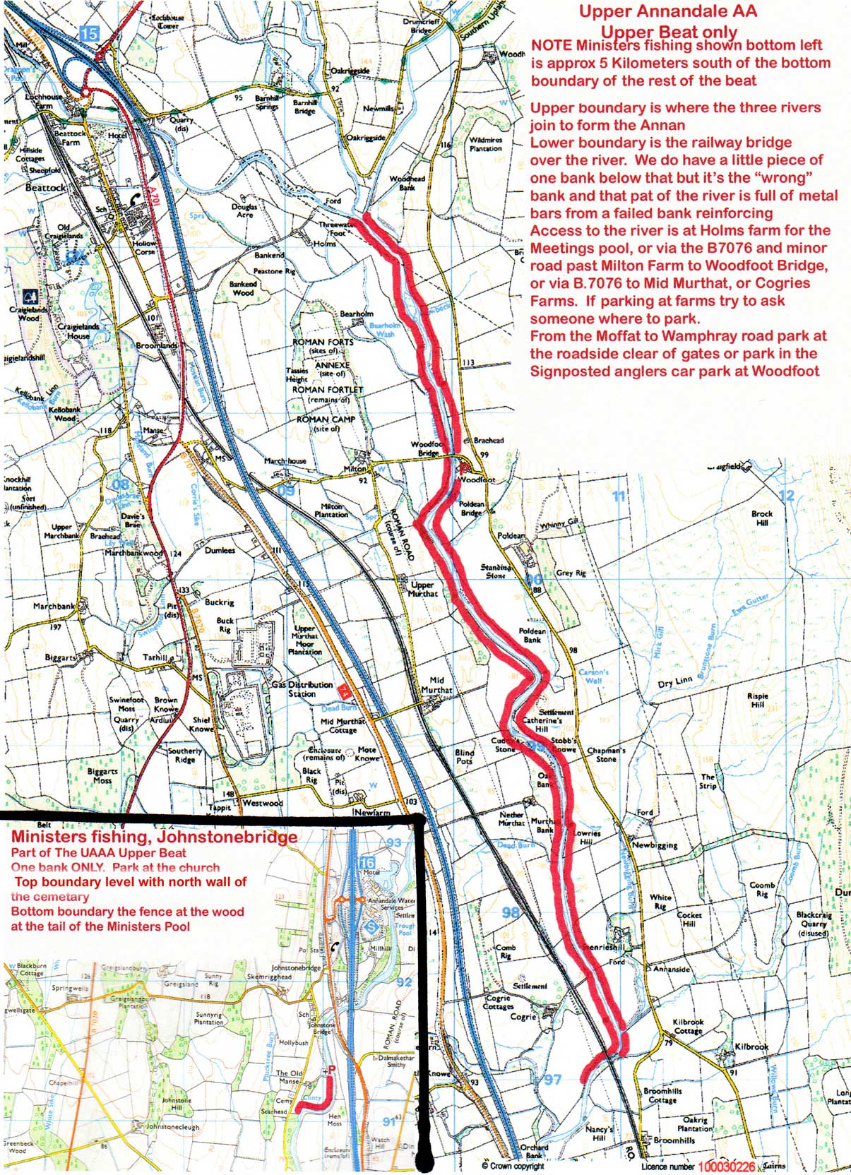
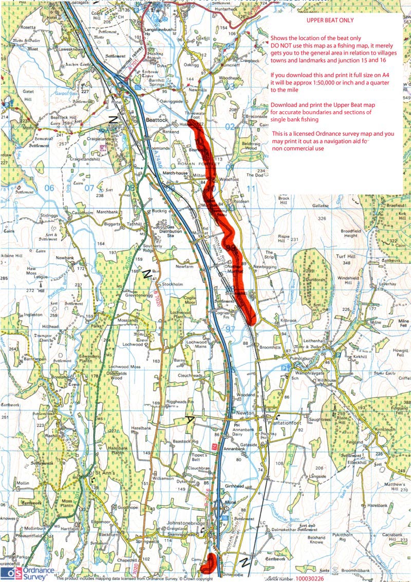
On this page you will find an Upper Beat Map, an Upper motoring map, and a map of the stretch of the Upper Kinnel we rent from Crown Estates and share with the Annan Passport Scheme
All maps are Crown Copyright but duly licensed. It might be better to save them individually to your hard disk first (Approx 476 kb) and print from there. On an A4 sheet top map will reproduce
at approx 1:25,000 scale (2 1/2 inches to the mile - ish)
Middle map at approx 1:50,000 (inch and a quarter to a mile - ish)
When printing ensure you have checked any box which makes it fit the paper as it is larger than A4 on file
Right click and download the map to your computer as an image and then print full size on a sheet of A4. That way it will be approx to scale of 2 1/2 inches to a mile or 1:25,000
Smaller scale map below this one to locate you in the landscape
Print the lower map only for driving. Print the upper map as a fishing map
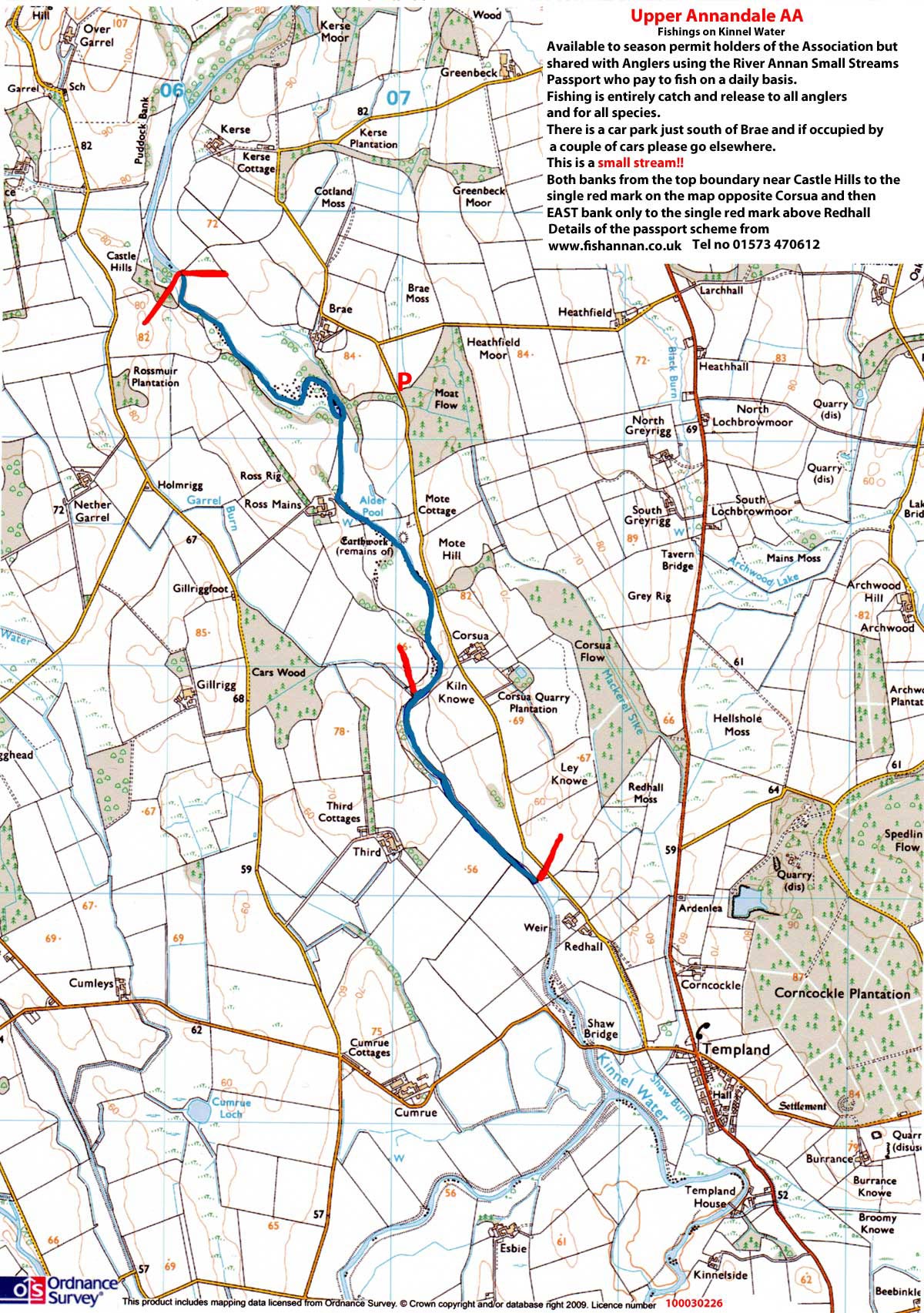
Map of the stretch of the Kinnel above Templand which is part of our lease from Crown Estates. Season Permit holders of the Association (both beats) may fish it but it needs to be stressed it is a SMALL Stream. Because of that it is shared with anglers on the Annan Small Streams Passport scheme so please give way if it's occupied. After all you can fish it anytime
This is a slightly larger scale 1:20.000 approx but the faint blue squares are still 1 kilometre across. IMPORTANT - Season extension 16th to 30th November does not apply to ANY tributary of the Annan